From highway corridors and cadastral records to 3D reality capture, web GIS platforms, and AI-powered automation — end-to-end spatial intelligence for governments, businesses, and researchers.
Overview
Geospatial technology captures, analyzes, and visualizes data tied to specific locations on Earth — transforming raw coordinates into actionable intelligence. Our pipeline spans four core stages, each building toward smarter, faster spatial decisions.
Satellites, drones, LiDAR, GPS, and ground sensors collect precise location-linked data from the physical world.
Geographic Information Systems organize spatial data into layered digital maps for analysis and planning decisions.
Algorithms detect patterns, measure distances, model terrain, and forecast changes across landscapes.
Machine learning turns massive spatial datasets into smart insights enabling real-time decisions and predictions.
Highway Division
Precise mapping and digitization of highway networks enables smarter road planning, maintenance, and safety management across national and state highway corridors.
Road Centerline Mapping — Accurate highway centerlines with chainage markers
Bridge & Culvert Inventory — Spatial records of all bridge structures and water crossings
Road Condition Survey — Pothole, crack, and surface defect mapping via mobile LiDAR
Traffic Sign Inventory — GPS-tagged road sign classification and attribution
ROW Mapping — Right-of-Way boundary digitization for encroachment detection
Vehicle-mounted LiDAR captures 3D point clouds of entire highway corridors — roads, bridges, signage, utilities — at driving speed.
USE CASES: Corridor mapping · Road asset inventory · Pavement analysis
Drone and aerial imagery processed into high-resolution orthomaps for highway planning and land acquisition boundary marking.
USE CASES: Land acquisition · Design planning · Environmental studies
End-to-end highway GIS database creation with all road assets, structures, pavement condition, and attribute data linked to spatial locations.
USE CASES: NHAI compliance · State PWD · Road safety audits

Cadastral Division
Converting physical land records into accurate, queryable spatial databases for governance and land management.
📋 What is Cadastral Mapping?
The precise spatial recording of land parcels, ownership boundaries, and property rights — the legal and administrative foundation for land governance, taxation, and urban planning.
🗂️ What is Land Base Digitization?
Converting physical maps, paper records, and survey plots into geo-referenced digital layers — creating a living spatial database linking parcels to ownership, revenue, and land-use records.
Scanning and geo-referencing land survey maps to extract precise property boundary polygons.
Linking survey numbers, khasra IDs, and plot numbers to digitized boundary polygons.
Connecting RoR (Record of Rights), jamabandi, and ownership data to spatial parcel layers.
Rectifying historical cadastral sheets, SOI toposheets, and settlement maps to modern CRS.
Validating gaps, overlaps, slivers in boundary data to ensure topological integrity.
Final delivery as ESRI Shapefile, GeoJSON, or RDBMS-ready formats with full metadata.
Land Use & Land Cover mapping using high-resolution drone imagery — vegetation, water bodies, built-up areas, bare land.
Precision digitization of gas pipeline networks (IGL) and infrastructure — underground and surface utility records.
3D Reality Capture
Ground survey and laser scanning technologies that create precise digital twins of the physical world.

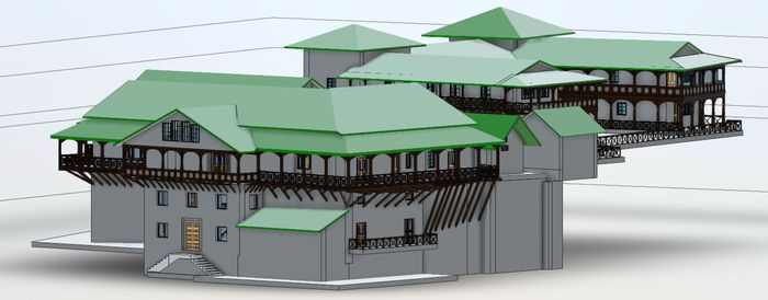
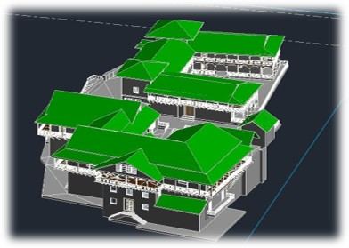
Complete interior and exterior 3D scanning of historic structures. Creates BIM-ready digital replicas for conservation and restoration planning.
TECH: 3D Laser Scanner · Photogrammetry · BIM

Vehicle-mounted LiDAR sensors capture millions of 3D points per second while driving. Delivers corridor maps, road inventories, and asset data at scale.
TECH: Mobile LiDAR · Point Cloud · SLAM

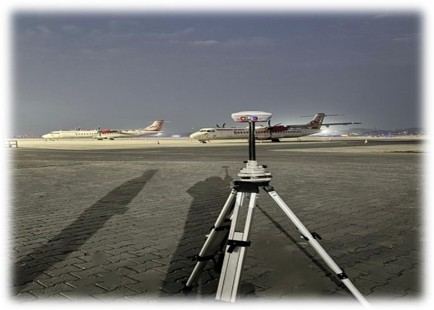
Differential GPS provides centimeter-level precision for ground control points. Essential for aeronautical surveys, boundary demarcation, and infrastructure alignment.
TECH: Differential GPS · RTK · Base-Rover

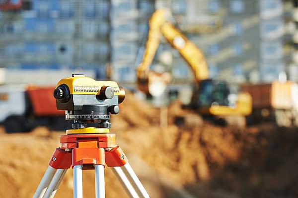
Comprehensive ground surveys capture precise feature marking and elevation data. Topographic maps guide civil engineering and land development projects.
TECH: Total Station · GNSS · DTM/DEM
Building Analytics Division
Aerial and satellite-based analysis of built environments — without site visits.
📍 USA
Temporal aerial imagery analysis compares before-and-after images to detect roof damage from storms, fire, or age. Used for rapid insurance claims processing.
📍 Australia
Identification and attribution of detailed building properties — roof type, material, staircases, and entry points — from aerial imagery without site visits.
📍 Australia
High-precision building footprint extraction for urban planning. Creates accurate 2D/3D outlines of rooftops from aerial or satellite imagery.
Spatial Analysis Division
Proximity analysis measures spatial relationships and distances between geographic features. It answers questions like: "How many villages are within 10km of a bank branch?" or "Which areas lack healthcare access within 5km?"
📌 CASE STUDY — BANK PROXIMITY, INDIA
Spatial analysis for microfinance and government sectors. Radial zone mapping (10km, 25km, 35km) around bank branches helps identify underserved villages and optimize branch placement.
Branch reach analysis, ATM placement, microfinance risk zoning
Hospital coverage mapping, underserved area ID, ambulance routing
School enrollment zone planning, dropout-distance correlation
Road connectivity analysis, utilities expansion prioritization
Market proximity for farmers, irrigation canal reach analysis
Web GIS Division
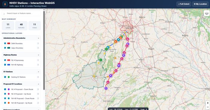
Interactive geospatial portals and analytics dashboards for real-time spatial decision making.
Multi-layer interactive maps with draw, measure, query & filter tools. Supports Shapefile, GeoJSON, KML.
Real-time KPI panels, heatmaps, charts & spatial drill-downs for infrastructure, utilities and governance.
Branded map portals with basemap switching, offline tile caching, and role-based access control.
USE CASES: City Gas Distribution (BlueView) · Highway Asset Monitoring · Urban Planning Portals · Utility Network Management · Land Record Dashboards · Disaster Risk Mapping
Automation Division
Streamlining geospatial data pipelines from ingestion to delivery using smart automation and AI.
⚙️ Geospatial Process Automation
🤖 AI & Machine Learning Integration